FAQ
Yes, there is. Water is stored at the campsites in tanks. However, the stored water cannot be guaranteed safe to drink, as there are numerous ways that it can become contaminated. Drinking untreated water such as creek water, bore water or sometimes even rainwater, can lead to illnesses such as gastroenteritis and diarrhoea. Signs have been placed at each site stating-
‘Untreated rainwater, do not drink’
These signs have been required by the land managers and are in common usage throughout the state of Victoria.
Walkers should always carry sufficient drinking water with them or have the means to treat the stored water.
For more information, follow the link to the Parks Victoria website information – Be safe plan ahead – Drinking Water
Yes. The sections are interspersed between the 14 Campsites. Different sections vary from 8-21 km and can be accessed by day walkers.
Also see: Campsites
The walk officially begins and ends at the Visitor Information Centre on Lee Breakwater Road, however it is possible to start and exit at many access points (refer to map). The walk completes a loop, and can be done in either direction; however anti-clockwise is the recommended direction (particularly for Discovery Bay).
Yes, at road crossings and some camping spots.
The track is signed by red metal triangular arrows mounted on posts. Also used in conjunction with an arrow is a plastic sign with a blue background and the words ‘Great South West Walk’ in white lettering. Some roads are also signposted with trailhead signs that have the international walker logo, plus the lettering GSWW in white on a brown background.
While walking take note of emergency marker numbers as these are reference points for rescue.
There are 14 campsites for the specific use of walkers.
A cleared tent site
A shelter at all of the 14 campsites (many of our brochures and maps will state 16. Please refer to Campsites page for clarification)
A pit toilet
A water supply. -(Please refer to the first item on this FAQ sheet regarding water)
A wood BBQ or stone fire ring. (A fuel stove should be carried, especially on coastal sections.)
A logbook is placed in the vicinity of camps. Please record your arrival & departure date & make comments in the books so that track usage can be determined and maintenance required. Also in case of fire, the logbook assists with locating walkers.
Also see: Campsites
Yes, but it’s not advisable to leave vehicles out and unattended overnight. Most campsites do not have direct private vehicle access.
Please register your vehicle at the Information Centre – cars may be parked here.
If required, please try the above transport options first. If none of these can be arranged, the Friends of the GSWW may be able to help.
Contact the Walker Liaison Officer. Arrangements must be made prior to departing walk and is dependent upon availability. Telephone 0428 234248 or email- [email protected]
Visitor Information Staff will be aware of conditions (or can find out) about the state of Cobboboonee National Park and eastern Lower Glenelg National Park. Generally the water table rises (up to 45 cm) between June and late November depending on the season. You can re-route your walk along forest roads.
For beach walking, you should examine tide tables (in the local newspaper at Information Centre or this website).
The track is graded EASY/MEDIUM. Take care when planning your walk, ensuring that the distance chosen is not too great for individual hikers, and for your own fitness level.
Other than forest sections, the GSWW can be enjoyed at any time of the year. We do not recommend walkers be in the forested sections on days of total fire ban (TFB). December to April are the most likely months that total fire ban day/s may be declared.
Check the 7-day outlook for the weather (on this website or BOM site) and look for strong Northerly winds accompanied by temperatures above 35 degrees Celsius, and you can make your own assessment of the likelihood of a declaration.
Try and time your walk so you are not in the forest in these conditions.
Do not expect an official bushfire warning. Due to the sheer size and geographic spread of Victoria’s parks and forests, it is not possible for every visitor to personally receive a warning. It is your responsibility to remain alert and aware of current weather and fire conditions!
Each campsite has a maximum of 20 persons per night. The web site booking system will only allow for this number.?
Ideally, supplies should be purchased and packed economically some time before setting out so that no unnecessary packaging is carried. Supplies can be purchased in Portland, a hearty meal can be purchased at Bridgewater, either at the kiosk (open 7 days) There is also a kiosk in Nelson which stocks dehydrated food, as well as the Nelson Hotel and Nelson Roadhouse if you would prefer a home-cooked meal. You also have the option of posting yourself a food package to the Nelson Post Office, Nelson Vic 3292.
You can purchase maps and books at our online store. These maps and brochures are available over the counter at Portland Visitor Information Centre PO Box 152, Portland 3305. Phone (03)5522 2135?
or Nelson Visitor Information Centre, Leake St Nelson Vic 3292. Phone (08) 8738 4051
Broadsheet maps and information can also be obtained in person from:
Hamilton, Port Fairy, & Casterton Information Centres
Bridgewater Bay Kiosk, Cape Bridgewater
Nelson Kiosk, Nelson
Lady Nelson Visitor Centre, Jubilee Hwy, Mt Gambier. S.A.
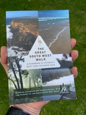
View booklet and map covers that are available.
Telephones are located at the kiosk at Cape Bridgewater, and in Nelson opposite the kiosk.
There is limited mobile phone reception along the walk, with the largest carrier up until now, having the most reliable coverage.
In an emergency, dialling 112 will allow your call to be transferred to the dominant carrier and connect you with emergency services provided you are in an area that has reception.
As with all fringe areas for mobile phones, your best chance of reception is to move to an elevated position.
Radio reception is also patchy but will improve with some elevation and directional rotation.
Most low powered small portable radios will be fairly ineffective; however, the best chance for radio reception is at night.
If you would prefer some comforts of home, a commercial camping ground, two motels, a hotel, a guest house, and self-contained cabins can be found at Nelson. Bed and Breakfast & holiday house accommodation are available at Bridgewater Bay and a bungalow at Trewhella. Accommodation is also available at Cape Nelson Lighthouse.